34. Champlain perceives the Indigenous people's mental map of eastern North America
And finds the location of the first permanent settlement in New France, a place the Algonquin call Kebec.

Treaties, after all, were not vehicles for protecting land or even sharing land. They were vehicles for acquiring land. Almost without fail, throughout the history of North America, every time Indians signed a treaty with Whites, Indians lost land. I can’t think of a single treaty whereby Native people came away with more land than when they started. Such an idea, from a non-Native point of view, would have been dangerously absurd.
- Thomas King, “The Inconvenient Indian”
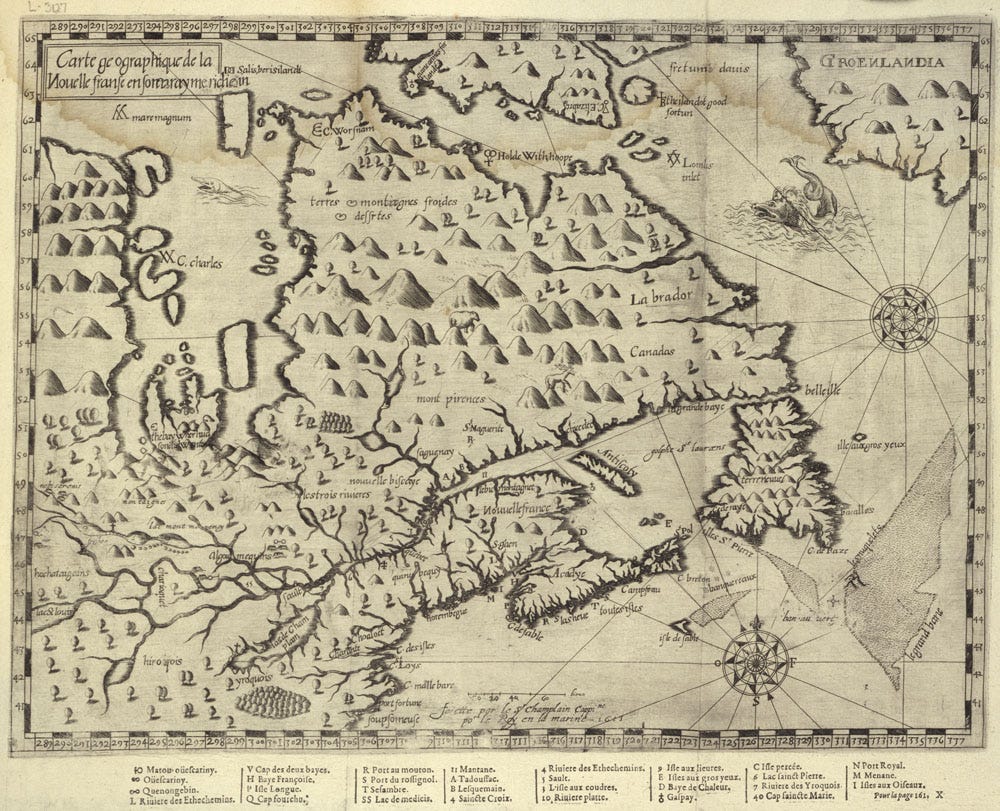
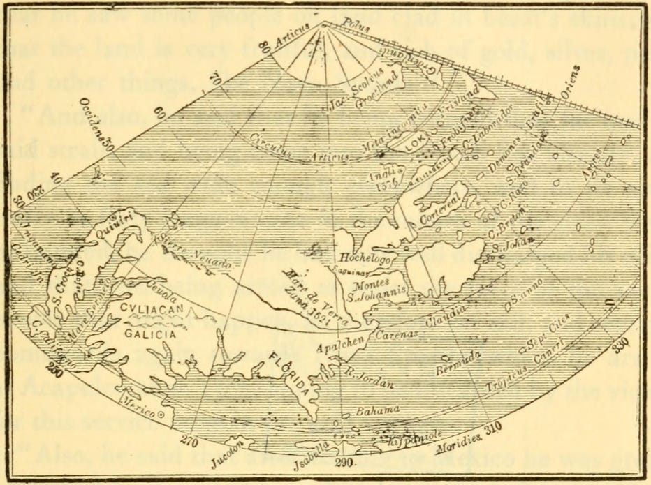
In 1603, when Samuel de Champlain entered a treaty with three Indigenous nations at the Great Tabagie of Tadoussac, the interior of this newly discovered land mass was completely unknown to him. His mental map was a shadowy outline. It was Terra Incognita – Unknown Land.
Maps of the era showed a coastline from Labrador to Florida with suggestions for rivers and inlets. The Gulf of St. Lawrence and the St. Lawrence River were shown but beyond that, the great interior was a fanciful suggestion with extremely distorted features.
Few explorers before Champlain were capable mapmakers. They may have been good navigators, but few had the technical skills to draw accurate maps based on navigational readings. Samuel de Champlain had all those skills as well as the discipline to ensure accuracy.
Fishermen and whalers who had sailed these waters for nearly a century had few incentives to provide accurate maps. They sought to protect their commercial fishing interests from competition.
This dearth of knowledge meant explorers heading to North America were literally sailing into the unknown.
Indigenous mapmaking
These lands may have been unknown to Champlain and Pont-Gravé but eastern North America was well known to the Algonquins and Innu. These nations had memorized a detailed mental map of the rivers, lakes, portage routes and trails not only of their own territories but also that of neighbouring nations.
They measured distances between significant destinations in days and months (moons). They were avid star-readers. They knew the points of the compass by looking at the growth of tree branches, by noting star locations and recalling landmarks such as hills and mountains.
They also knew where dangers lay. They were especially on guard against their mortal enemies, the Haudenosaunee (Iroquois), with whom they regularly fought in bitter battles. But they also knew the locations of their allies, the Algonquin, Ojibway and Wyandot.
They knew the dangers lurking in forests such as wolverines (they ranged further south than they do today), black bears and packs of wolves. Even mountain lions were known to range in their territories of North America.
So, the indigenous nations needed no maps. All this information was imprinted in memory and would be passed down from generation to generation and added to as new information came to their attention. For those still learning the landmarks, etching in tree bark would serve as guideposts for travelers.
So, in many ways the Indigenous nations that Champlain and the French explorers met were as advanced as or even beyond anything the European nations could claim. The Indigenous peoples were healthy, strong, quick of mind, yet full of joy even as they reflected on the frailty of their existence. They had no illusions about the world around them.
Samuel de Champlain was a man of deep empathy for these people. He tried his best to understand them. It was through this empathy that he perceived the outline of their world they inhabited from the salt seas of the far north to the edge of their world ending at another salt sea far to the south.
It was from this perception he was able to draw first in his mind and then on paper a map of eastern North America. He would use this knowledge to locate the first permanent French settlement and to explore the vast interior of what would become New France.