
33. The Great Tabagie of Tadoussac (1603)
In May 1603, the French and a coalition of Indigenous nations established an enduring alliance based on mutual understanding, trade and trust.

Tadoussac (pronounced Tah-do-sack) hugs a small inlet at the mouth of the Saguenay River as it empties into the St. Lawrence River. Today it is a small village on the northern bank of the St. Lawrence River roughly 200 km from Quebec City. In the history of Canada, its importance can not be overstated. This article explores why.
So few Canadians are aware of this village as Quebec City and Montreal dominate the landscape of the Province of Quebec, at least I wasn’t. It was only when I started researching the voyages of Samuel de Champlain that I understood the importance of this little village.
Tadoussac, or tatouskak as it was known by the Indigenous nations, provided a protected harbour for the Montagnais (Innu) people to set up a summer trading camp. It was a well-known location amongst the Indigenous nations of the east coast. The Mi’kmaq called it Gtatosag while the Innu called it Totauskak meaning “breasts” or “udders.” An odd name no doubt but historians suggest it may refer to a pair of rounded hills near the harbour.
The Saguenay river: gateway to the interior of Quebec
Only two locations at the mouth of the Saguenay were large enough to accommodate the hundreds of Indigenous peoples who arrived here each summer to trade with the Innu. One was on the western bank; the other was Totausak.
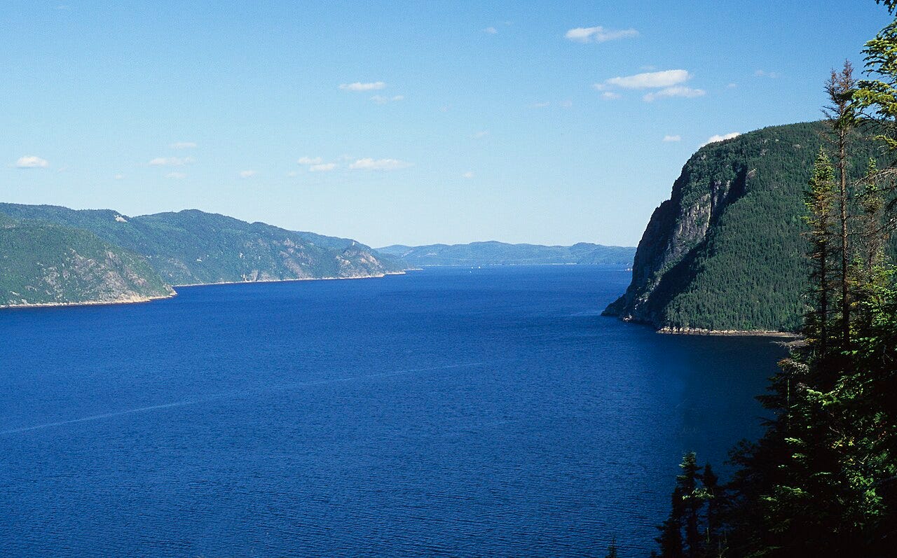
The Saguenay river’s shoreline at its mouth gave way to massive walls of rock on both sides providing the Innu traders with a spectacular scene as they made their way to and from their summer trading camp.
At the end of a summer of trading, the Innu broke camp at Tadoussac and travelled upstream from the St. Lawrence hugging the banks of the river. The Saguenay narrowed into a fjord with walls on both sides reaching upwards of 200 meters in some places. Those rock faces dropped below the water’s surface to a depth of an astonishing 250 meters deep at some places.
Keep reading with a 7-day free trial
Subscribe to The Story of Canada: Beyond Brant and Brock to keep reading this post and get 7 days of free access to the full post archives.